|
作者:萊斯特•布朗
美國國家海洋和大氣總署實驗室的科學家在上個月(1999年4月)指出,來自中國大陸北方的沙塵暴已經抵達美國,從加拿大到亞利桑那州都蒙上了一層灰土。他們還表示,沿著落磯山脈一路綿延的山,都已經被中國大陸來的塵土吹的一片霧濛濛。
這場沙塵暴來的並不令人感到意外。在三月初,中國的人民日報就曾報導,本季最早的沙塵暴已經抵達北京 (自有年度紀錄以來,這是最早侵襲北京的沙塵暴之一)。去年和今年所發生的沙塵暴肆虐的情形,是記憶中最嚴重的,由此,我們知道廣大的中國西北牧地和耕地,已發出土壤嚴重流失的警訊。
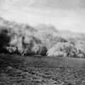
中國最近發生的沙塵暴,另人聯想到曾發生在美國的沙塵暴。(照片提供:美國農業部)
巨大的沙塵暴定時地會從數百哩遠以外的地方,來到包括北京這些中國東北的人口集中地,遮蔽了陽光,降低能見度,減緩交通流速,並導致機場關閉。根據報告指出,這些東部地區的居民就像美國在1930年代經歷沙塵暴時一樣,他們用舊布塞住窗戶的縫隙來防止沙塵進到屋子裡。
由西向東吹進的風,常常夾帶著中國西北方的泥沙向北韓、南韓以及日本一路東進。這些國家常抱怨阻隔陽光、又遮蔽了萬事萬物的大量沙塵。帶著來自選民的壓力,由15位日本立委和8位南韓立委所組成的三國三邊協議會,正和中國大陸的官員們討論著該如何來抵禦塵暴。
一般新聞報導都將沙塵暴歸因於過去三年的乾旱。但事實上,乾旱只是將這快速惡化的情形突顯出來。中國西北地區的人口壓力早已超過土地的負荷力。過多的人口、牲畜和農耕地,是造成土地過度負荷的主因。但是要供養美國五倍多的13億人口確實不容易。
沙塵暴的複雜身世
除了西北當地對環境自然資源的需求壓力外,北京當局於1994年決議,那些被用於建設的農地可以由開墾其他地區的土地作為農地來補償, 加速了今日的生態浩劫。在「土地利用政策」一文當中,中國地理學家楊洪(音譯)和李秀彬(音譯)指出上述的補償政策對環境造成的影響。廣東、山東、浙江和江蘇等快速發展的沿海省份,因為都市成長以及工業化的需求而失去了大量的農耕地。他們因此付錢給其他省份,開發新的耕地來彌補他們所失去的農地。這樣的做法使得西北地區省份在政策開始的初期呈現快速的經濟成長,例如內蒙古 (耕地擴增了22%)、甘肅、青海、寧夏以及新疆等等地。
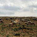
蒙古的畜牧羊群。照片版權歸屬 美國國家再生能源實驗室(照片提供:網路影像資料庫)
當西北各省已經嚐到過度開墾和放牧的苦果時,他們卻開墾更多的邊緣地帶,土壤侵蝕的情況因而加劇。如今,中國人民因為土壤沙漠化而棄守家園,紛紛向東邊移民,這與當年美國發生沙塵暴時,居民從南部大平原往西移至加州的情形並無不同。
相較於將地上物清除的開發耕地方式,牲畜量的增加則是把地表植被淨空,兩者一樣導致土表的裸露。緊接著1978年的經濟改革和廢除牲畜的總量管制,牲口數量從此急速上升。今日大陸共有1億2千7百萬頭牛,和2億7千9百萬頭羊,而美國則只有9,800萬頭牛和900萬頭羊。
在青海省東部的海南藏族自治州共和縣,當地的草原本可以負荷370萬頭羊,但根據1998年底的估算,當地的羊隻已達550萬頭之多,遠遠超過土地的承載量,這導致當地草原地的快速消失和沙漠化,並導致沙丘的形成。
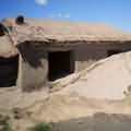
在蒙古地區,沙漠的面積不斷擴大。(照片提供:美國地質調查局)
艾瑞克•艾克荷姆(Erik Eckholm)在紐約時報的報導中指出,漸漸堆高的沙丘是新沙漠在青康藏高原東部成形的跡象。根據史料記載,高原當地曾是「草比馬兒高」的草原,是傳說中藏族牧羊人的家。根據官方報導,每年約有900平方英哩的土地變成了沙漠。比這大數倍的土地,同時面臨著產量降低與超限利用的問題。
【文章連載】
■沙塵暴又一噩耗 (上) (下)
全文與圖片詳見:http://www.gristmagazine.com/maindish/
brown052901.stm
版權歸屬 Earth Day Network,社團法人台灣環境資訊協會(許嘉玲 譯,林子倫 審校)
|
|
by Lester R. Brown
Last month, scientists at the National Oceanic and Atmospheric Administration laboratory in Boulder, Colo., reported that a huge dust storm from northern China had reached the U.S. "blanketing areas from Canada to Arizona with a layer of dust." They reported that along the foothills of the Rockies, the mountains were obscured by the dust from China.
This dust storm did not come as a surprise. In early March, the People's Daily reported that the season's first dust storm -- one of the earliest on record -- had hit Beijing. These dust storms, coupled with last year's, were among the worst in memory, signaling a widespread deterioration of the rangeland and cropland in the country's vast northwest.
China's recent dust storms are reminiscent of the U.S. Dust Bowl. Photo: USDA.
Huge dust plumes routinely travel hundreds of miles to populous cities in northeastern China, including Beijing, obscuring the sun, reducing visibility, slowing traffic, and closing airports. Reports of residents in eastern cities caulking windows with old rags to keep out the dust are reminiscent of the U.S. Dust Bowl of the 1930s.
Eastward-moving winds often carry soil from China's northwest to North Korea, South Korea, and Japan, countries that regularly complain about dustclouds that both filter out the sunlight and cover everything with dust. Responding to pressures from their constituents, a group of 15 legislators from Japan and eight from South Korea is organizing a tri-national committee with Chinese lawmakers to devise a strategy to combat the dust.
News reports typically attribute the dust storms to the drought of the last three years, but the drought is simply bringing a fast-deteriorating situation into focus. Human pressure on the land in northwest China is excessive. There are too many people, too many cattle and sheep, and too many plows. Feeding 1.3 billion people, a population nearly five times that of the United States, is not an easy matter.
A Dust-up
In addition to local pressures on resources, a decision in Beijing in 1994 to require that all cropland used for construction be offset by land reclaimed elsewhere has helped create the ecological disaster that is now unfolding. In an article in Land Use Policy, Chinese geographers Hong Yang and Xiubein Li describe the environmental effects of this offset policy. The fast-growing coastal provinces, such as Guandong, Shandong, Xheijiang, and Jiangsu, which are losing cropland to urban expansion and industrial construction, are paying other provinces to plow new land to offset their losses. This provided an initial economic windfall for provinces in the northwest, such as Inner Mongolia (which led the way with a 22 percent cropland expansion), Gansu, Qinghai, Ningxia, and
Xinjiang.
Sheep grazing in Mongolia. Photo: NREL/PIX.
As the northwestern provinces, already suffering from overplowing and overgrazing, plowed ever more marginal land, wind erosion intensified. Now, accelerating wind erosion of soil and the resulting land abandonment are forcing people to migrate eastward, not unlike the U.S. westward migration from the southern Great Plains to California during the Dust Bowl years.
While plows are clearing land, expanding livestock populations are denuding the land of vegetation. Following economic reforms in 1978 and the removal of controls on the size of herds and flocks that collectives could maintain, livestock populations grew rapidly. Today China has 127 million cattle, compared with 98 million in the U.S. Its flock of 279 million sheep and goats compares with only nine million in the U.S.
In Gonge County in eastern Quinghai Province, the number of sheep that local grasslands can sustain is estimated at 3.7 million, but by the end of 1998, sheep numbers there had reached 5.5 million, far beyond the land's carrying capacity. The result is fast-deteriorating grassland, desertification, and the formation of sand dunes.
The desert's a-growing in Mongolia. Photo: USGS.
In the New York Times, Erik Eckholm reports that "the rising sands are part of a new desert forming here on the eastern edge of the Quinghai-Tibet Plateau, a legendary stretch once known for grass reaching as high as a horse's belly and home for centuries to ethnic Tibetan herders." Official estimates show 900 square miles of land going to desert each year. An area several times as large is suffering a decline in productivity as it is degraded by overuse.
http://www.gristmagazine.com/maindish/
brown052901.stm
|