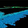
 2008年秋天,一項加拿大及美國的聯合科學探勘計畫將進行北極海海床勘測工作。美國及加拿大在這片海床可能擁有石油及天然氣資源的主權,並且可以控制這塊區域例如海床採礦等活動。
這項探勘將會由美國及加拿大以兩艘船合作進行,兩個國家將所獲得的探勘資料,以聯合國海洋法公約(Convention on the Law of the Sea)所訂的準則,來設定這塊海域大陸棚最外圈的範圍。
這片符合公約準則,由海岸延伸出去大約200海浬的大陸棚、海床及海床底土是科學界非常感興趣,也是具有巨大經濟發展潛力的區域。
衛星資料顯示,2008年北極海冰綿延的範圍是30年前、開始進行空中觀測以來次小的一年。今年也延續去年,是地球西北通道(the Northwest Passage)直航道暢通無阻的第二年,這種情況使得船隻更容易前往北極海(Arctic Ocean)。
美國地質調查局(The U.S. Geological Survey,USGS)以「美國海防巡邏艇赫利號(U.S. Coast Guard Cutter Healy)」,先開始在2008年9月6日到10月1日進行資料蒐集,勘測北極海海床。
加拿大地質調查局(The Geological Survey of Canada)及加拿大自然資源部(Natural Resources Canada)將以加拿大海防(Canadian Coast Guard)船艦「露易斯聖洛朗號(Louis S. St. Laurent)」跟隨赫利號,前往進行海床底土地質研究。
加拿大總理哈波(Stephen Harper)在宣布這項地質勘測計畫時表示:「要擁有北極主權第一要件就是使用她,不然就會失去她;要開發北極區域,就必須瞭解這塊區域;要保護北極區,就必須掌控北極區;要完成在北極區的一些目標,就必須要駐守北極區。」
哈波表示這個任務會「使用現代地質科學的全套工具來鼓舞經濟發展,也會捍衛加拿大在北極區的主權。在妥當管理之下,加拿大在這個令人驚喜的資產上所分享到的,將會為未來幾個世代挹注繁榮景象。地質勘測工作將會為未來的資源開發鋪路。」
將在航行途中登上「露易斯聖洛朗號」的美國地質調查局科學家休奇森(Deborah Hutchinson)表示:「要在這塊區域獲取資料是所費不貲,極具難度,並且有時是危險的,這個「雙艦實驗」可以讓美國及加拿大蒐集並分享互補資料。兩個國家可因分享資源及資料獲益,也能藉由在偏遠北極海區域使用兩艘破冰船,增加成功的可能性。」
A joint Canada-U.S. scientific expedition this fall will map the unexplored Arctic sea floor where the U.S. and Canada may have sovereign rights over oil and gas resources and control over activities such as sea bed mining.
The expedition will be collaboratively undertaken by the U.S. and Canada using two ships. Both countries will use the resulting data to establish the outer limits of the continental shelf, according to the criteria set out in the Convention on the Law of the Sea.
The extended continental shelf, the seafloor and subsoil beyond 200 nautical miles from shore that meet those criteria, is an area of great scientific interest and potential economic development.
Satellite data shows the extent of Arctic sea ice this year is the second-smallest since observations from space began 30 years ago. This is the second year in a row that the most direct route through the Northwest Passage has opened up, making access to the Arctic Ocean easier for ships.
The U.S. Geological Survey will lead data collection from September 6 to October 1 on the U.S. Coast Guard Cutter Healy to map the Arctic seafloor.
The Geological Survey of Canada, Natural Resources Canada will follow Healy on the Canadian Coast Guard ship Louis S. St. Laurent and study the geology of the sub-seafloor.
"Use it or lose it is the first principle of sovereignty in the Arctic," said Canadian Prime Minister Stephen Harper, announcing the geo-mapping program. "To develop the North we must know the North. To protect the North, we must control the North. And to accomplish all our goals for the North, we must be in the North."
Harper said the mission will "use the full tools of modern geological science to encourage economic development and defend Canadian sovereignty throughout the North."
"Managed properly, Canada's share of this incredible endowment will fuel the prosperity of our country for generations. And geo-mapping will pave the way for the resource development of the future," said the prime minister.
"The two-ship experiment allows both the U.S. and Canada to collect and share complementary data in areas where data acquisition is costly, logistically difficult, and sometimes dangerous," said USGS scientist Deborah Hutchinson, who will sail aboard Louis.
"Both countries benefit through sharing of resources and data as well as increasing likelihood of success by utilizing two ice-breaker ships in these remote areas of the Arctic Ocean," Hutchinson said.
全文及圖片詳見:ENS


