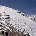
 世界銀行工程師維佳樂(Walter Vergara)在其最新的研究報告《氣候變遷對拉丁美洲的影響》中指出,自1940年以來,玻利維亞境內的恰卡塔雅(Chacaltaya)冰河面積已消失了99%。
名列南美最高冰川之一的恰卡塔雅冰河,是第一個因為氣候變遷而融化消失的冰河,這個已有18,000年歷史的冰川,預計將在2008年完全消失。
根據秘魯氣象水文中心的報告顯示,自1970年以來,安地斯山脈的冰川面積已有20%化為烏有。而安地斯山脈冰川的消失,正威脅著3千萬人口的水源供應,科學家更表示,位於低海拔的冰川可能在10年消失不見。
在面臨水源供給、農業和發電危機的情況下,世界銀行和援助機構全球環境基金共同合作,為當地社區尋求應變的策略。
此外,世界銀行在4月也與日本太空實驗室簽署協議,由實驗室提供最新數據和高解析度的影像,針對安地斯冰川縮小的速度做更完善的監控。全球熱帶冰川數量中,約有70%位於貫穿秘魯、玻利維亞和厄瓜多的安地斯山脈。
 冰川的其中一項功能,是透過在乾燥溫暖季節所產生的溢流,調整水源的供給,以及在潮溼寒冷的季節時以冰的形態儲存水源。維佳樂警告,一旦冰河縮小,就會失去水源調節的功用。
而熱帶安地斯所含蓋的範圍,是3千萬人的家園,也是全球生物多樣性的歸屬,都會受到影響,最後,水源短缺將讓山區社群、農業和整個生態系統陷入困境。
該區域內的許多大城市都仰賴冰川溢流做為水源。厄瓜多首都基多50%的水源取自冰河流域,玻利維亞首都拉巴斯則約有30%的水源來自冰川。維佳樂指出,秘魯國內消失的冰川面積約相當於首都利馬10年的用水量。
由於安地斯山脈所含蓋的國家多採用水力發電,因此當地的電力供給也會受到影響。秘魯約有81%的電力來自水力發電,哥倫比亞73%,厄瓜多72%,玻利維亞則佔50%。
在冰河學、遙感探測、農業、水電供給和田園發展等專家學者所組成的智庫協助下,世界銀行和全球環境基金極力推動建立應變計劃。
多樣性能源供給、替代性作物轉種,以及發展先進的灌溉系統,也能幫助安地斯當地社區對於氣候變遷的影響做出應變。
About 99 percent of the Chacaltaya glacier in Bolivia has disappeared since 1940, says World Bank engineer Walter Vergara, in his new report, "The Impacts of Climate Change in Latin America."
One of the highest glaciers in South America, Chacaltaya is one of the first glaciers to melt due to climate change. Although the glacier is over 18,000 years old, it is expected to vanish this year.
Since 1970, glaciers in the Andes have lost 20 percent of their volume, according to a report by Peru's National Meteorology and Hydrology Service.
Loss of glaciers in the Andes mountain range is threatening the water supply of 30 million people, and scientists say the lower altitude glaciers could disappear in 10 years.
With water supplies, agriculture, and power generation at risk, the World Bank and the funding agency Global Environment Facility are working together to develop adaptation strategies for local communities.
In addition, the World Bank signed an agreement this month with the Japanese Space Agency that will start providing advance data and high resolution images to better monitor Andes Glacier retreat.
Seventy percent of the world's tropical glaciers are in the high Andes Cordillera of Peru, Bolivia, and Ecuador.
One of the functions of glaciers is to regulate water supply through runoffs during dry and warmer periods and store water in the form of ice during wet and colder periods. As glaciers retreat, this function will be lost, warns Vergara.
The entire range of the tropical Andes, home to over 30 million people and host to the vital global biodiversity, will be affected. As a result, shrinking water supplies will leave mountain communities, agriculture, and entire ecosystems high and dry.
Large cities in the region depend on glacial runoffs for their water supply. Quito, Ecuador's capital city, draws 50 percent of its water supply from the glacial basin, and Bolivia's capital, La Paz, draws 30 percent of its water supply.
The volume of the lost glacier surfaces of Peru is equivalent to about 10 years of water supply for Lima, Vergara says.
Power supplies also will be affected as most countries in the Andes are dependent on hydroelectric power generation. Peru gets 81 percent of its electricity from hydropower, Colombia generates 73 percent from hydropower, Ecuador is 72 percent hydro-dependent, and Bolivia, 50 percent.
The World Bank and Global Environment Facility are supporting the development of adaptation plans prepared with the assistance of a multidisciplinary group that includes expertise in glaciology, remote sensing, agriculture, water and power supply, and rural development.
Diversification of energy supplies, shifts to alternative crops and development of advanced irrigation systems also can help Andean communities adapt to climate change.
全文及圖片詳見:ENS


