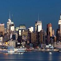
 一項由亞利桑那大學科學家所帶領的研究發現,2100年前美國數百沿海城市因海平面上升,將面臨失去10%左右的土地面積。
此研究為首個依海平面上升影響程度所做的分析報告,其內容包括人口5萬以上,最低窪的48個美國沿海城市。
研究人員發現,墨西哥灣和南大西洋沿岸城市如邁阿密、新奧良、坦帕和維吉尼亞海灘等地影響程度尤為嚴重。
全美共有20個超過 30萬人、160個介於5萬至30萬人口的城市,其部分陸地海拔在6公尺或低於海拔6公尺,並與海相連接。
亞利桑那大學環境研究所聯合主任、教授地球科學和大氣科學,也是該報告的合著者奧弗佩克(Jonathan Overpeck)教授和他的同事,針對以上180個城市作檢視,試圖了解其中有多大面積的土地可能受1到6公尺海平面上升的影響。
據最新的科學預測顯示,至2100年,海平面將上升約1公尺。按目前全球變暖的速度,預計2100年後海平面每世紀將繼續上漲高達 1公尺。
首席研究員,亞利桑那大學地球科學系資深研究專家員米魏斯(Jeremy Weiss)表示:「根據最近海平面上升相關的科學論述,這就是我們即將面臨的命運。海平面上升可能帶來的影響有侵蝕陸地、間歇性洪災和永久性淹沒。」
魏斯還說:「按目前溫室氣體排放的速度預測,2100年前全球平均溫度將比現在高出華氏8度。」
同時他還預測:「如此暖化速度很可能在其後數百年,致使海平面上升幅度在最少4至6公尺區間。原因為部分格陵蘭和南極冰層,如夏天裏一個大冰塊在人行道上慢慢融化一般。」
海平面上升3公尺,這些城市平均有20%以上的土地可能會受到影響。包括波士頓和紐約等9個大城市,就現有陸地面積中有10%以上會受到威脅。
研究人員並證實,海平面上升6公尺的話,約1/3美國沿海城市的陸地面積將受到影響。
據2000年美國人口普查研究團隊證實,沿海各市居民達4050萬人。其中有20個城市的居民超過30萬。
Rising sea levels in hundreds of cities along U.S. coastlines will lose about 10 percent of their land area by 2100, finds new research led by University of Arizona scientists.
The research is the first analysis of vulnerability to sea level rise that includes every U.S. coastal city in the lower 48 with a population of 50,000 or more.
Cities along the Gulf of Mexico and southern Atlantic coasts such as Miami, New Orleans, Tampa and Virginia Beach will be particularly hard hit, the researchers discovered.
In total, 20 U.S. municipalities with populations greater than 300,000 and 160 municipalities with populations between 50,000 and 300,000 have land area with elevations at or below six meters (19.6 feet) and connectivity to the sea.
Co-author Jonathan Overpeck, a professor of geosciences and of atmospheric sciences and co-director of University of Arizona's Institute of the Environment and his colleagues examined how much land area from the 180 municipalities could be affected by one to six meters of sea level rise.
The latest scientific projections indicate that by 2100, sea levels will rise about one meter (39 inches). At the current rate of global warming, sea levels are projected to continue rising after 2100 by as much as one meter per century.
"According to the most recent sea level rise science, that's where we're heading," said lead researcher Jeremy Weiss, a senior research specialist in the University of Arizona's Department of Geosciences. "Impacts from sea-level rise could be erosion, temporary flooding and permanent inundation."
"With the current rate of greenhouse gas emissions, the projections are that the global average temperature will be eight degrees Fahrenheit warmer than present by 2100," said Weiss.
"That amount of warming will likely lock us into at least four to six meters of sea-level rise in subsequent centuries," Weiss predicted, "because parts of the Greenland and Antarctic ice sheets will slowly melt away like a block of ice on the sidewalk in the summertime."
At three meters (9.8 feet), on average more than 20 percent of land in those cities could be affected. Nine large cities, including Boston and New York, would have more than 10 percent of their current land area threatened.
By six meters, about one-third of the land area in U.S. coastal cities could be affected, the researchers determined.
The coastal municipalities the team identified had 40.5 million people living in them, according to the 2000 U.S. Census. Twenty of those cities had more than 300,000 inhabitants.
全文及圖片詳見:ENS報導


