") 聯合國和阿拉伯聯合大公國合作發表衛星圖集,其中顯示,人口成長、水資源稀少和氣候變遷加速了阿拉伯地區環境改變的腳步。
聯合國和阿拉伯聯合大公國合作發表衛星圖集,其中顯示,人口成長、水資源稀少和氣候變遷加速了阿拉伯地區環境改變的腳步。
聯合國環境規劃署和「阿布達比全球環境資料計畫」合作,於12月初發表《阿拉伯世界:環境變遷圖集》,檢視過去50年來的環境變化。
阿拉伯地區由22個阿拉伯國家聯盟會員國組成,有相同的語言、文化和宗教。阿拉伯地區分為3個相鄰區塊,橫跨2個大陸和2個半球,周圍環繞著5個不同海域。阿拉伯地區土地面積共1400萬平方公里,佔全球土地面積的9%,人口超過3.5億萬,其中超過半數居住在城市。
《阿拉伯世界:環境變遷圖集》是阿拉伯地區第一部記錄環境變遷的圖集,涵蓋超過80個地區,併呈過去和現在的衛星影像、地圖和照片,加上以科學證據為基礎的文字敘述。
前後對照研究顯示出大面積的土地利用改變、都市成長、海洋和海岸地區退化、水文改變和水域萎縮、棲息地消失以及氣候變遷的衝擊。
阿拉伯地區22個國家中有19國有水資源缺乏的問題。極少且變化極大的年度降雨讓阿拉伯地區特別容易受氣候變遷影響,其人均可用水預計到了2050年將減少一半。
。") 現今,整個阿拉伯地區的可耕作土地面積極為有限,只佔了14.5%的土地,處境岌岌可危。有17個阿拉伯國家受到沙漠化和土地退化的衝擊,引發糧食安全和人口遷徙等跨國界的問題。
現今,整個阿拉伯地區的可耕作土地面積極為有限,只佔了14.5%的土地,處境岌岌可危。有17個阿拉伯國家受到沙漠化和土地退化的衝擊,引發糧食安全和人口遷徙等跨國界的問題。
生物多樣性因棲地退化和消失而下降。阿拉伯地區已知受威脅物種有1746種,大部分都屬於極度瀕危保護等級。
這種種的問題大部分都是彼此相關的,也是人口增加和氣候變遷的直接後果。阿拉伯地區的氣候已是乾燥和極度乾燥,頻繁的旱災更是當地的最大天災。
阿拉伯地區在過去25年間已經歷了276次災難事件,超過40%發生在過去5年間。
在這之前,1980年至2008年間,旱災、地震、洪水和暴風雨影響了超過3千7百萬當地居民,造成的損失估計上看2百億美元。
透過前後對照的衛星影像,圖集提供了阿拉伯地區各國地景變遷的影像證據,包括沙漠綠化、灌溉農業擴張、油田擴張、沙漠化和植被消失、蟲害或柴薪砍伐、失控的都市化、海岸地區開發和極端氣候事件造成的衝擊。
Pushed by population growth, water scarcity and climate change, the pace of environmental change in the Arab region is accelerating, finds new research released by the United Nations and the Abu Dhabi government in the form of an atlas.
The UN Environment Programme and the Abu Dhabi Global Environmental Data Initiative this week released “The Arab Region: Atlas of Our Changing Environment,” which examines environmental changes over the past 50 years.
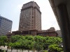
Abu Dhabi, UAE (Photo courtesy UNEP and Government of Abu Dhabi)
The Arab region, a group of 22 member countries of the League of Arab States sharing a common language, culture and religion, is divided into three contiguous clusters on two continents and in two hemispheres, bordering on five oceans and seas. Stretching across 14 million square kilometers, the region covers nine percent of the Earth’s total land area, with a population of over 350 million, more than half of whom live in cities.
The first report of its kind on the Arab Region, the atlas examines the environmental change that has taken place at more than 80 locations, with current and historical satellite images, maps and photographs, and a narrative based on extensive scientific evidence.
Before-and-after studies demonstrate wide-ranging land use change, urban growth, degradation of marine and coastal areas, altered hydrology and shrinking water bodies, loss of habitats and the impacts of climate change.
Water scarcity is a key environmental issue in 19 of the 22 countries in the region. Very low and highly variable annual rainfall makes the region particularly vulnerable to climate change impacts, and per-capita water availability is expected to be cut in half by 2050.
Today, only 14.5 percent of the region’s total land area is arable. Placing these limited arable lands at further risk, desertification and land degradation afflicts 17 of the Arab countries, triggering transboundary issues such as food insecurity and human migration.
Egyptian Rice farmer mourns his damaged rice crop after 70 days without water in a village northeast of Cairo, June 2008. (Photo by Nasser Nouri)
Biodiversity is declining due to habitat degradation and loss. The total number of known threatened species in the region stands at 1,746, with a majority of them classed as Critically Endangered.
Many of these major issues are interrelated and most are a direct consequence of increasing populations and environmental conditions associated with climate change. The arid to hyper-arid climate is plagued by frequent drought, which is the region’s most pressing natural hazard.
The Arab region has faced 276 disaster events in the past 25 years – more than 40 percent of them during the past five years.
Before that, between 1980 and 2008, droughts, earthquakes, floods and storms affected more than 37 million people in the region and caused damage estimated at US$20 billion.
With paired satellite images covering each of the Arab countries, the atlas provides visual evidence of landscape changes, such as the greening of the desert and increased irrigated agriculture; expansion of oil fields; deforestation and vegetation loss, insect infestations or harvesting for fuelwood; unchecked urbanization, development of coastal areas and impacts from severe weather events.
※ 全文及圖片詳見:ENS
作者
In my healing journey and learning to attain the breath awareness, I become aware of the reality that all the creatures of the world are breathing the same breath. Take action, here and now. From my physical being to the every corner of this out of balance's planet.