美西連年大旱 地表隆起0.4公分 | 環境資訊中心
國際新聞

美西連年大旱 地表隆起0.4公分

2014年08月28日
摘譯自2014年8月22日ENS美國,加州,聖地牙哥報導;姜唯編譯;蔡麗伶審校

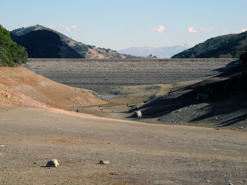
嚴重旱災對加州的影響,已經不只是限水和草地枯黃等地方性問題。加州大學聖地牙哥分校Scripps海洋研究所發現,因為水資源持續流失,美國西部地表已如鬆開的彈簧般隆起。

2014年2月美國加州的水庫,水位低於正常值。(來源:Ian Abbott)

GPS數據:水源短缺達240億噸 所有觀測站都「升高」了

Scripps研究人員Adrian Borsa、Duncan Agnew和Dan Cayan分析美西GPS觀測站搜集到的地面定位數據發現,水源短缺導致加州山脈隆起高達15公釐(1.5公分),全美西平均隆起4公釐(約為0.4公分)。

研究人員以GPS數據推估水源短缺近240億噸(62兆加崙),等於整個美西地表少了6吋深的水層。

除了來自國家科學基金會板塊邊界觀測站和其他資訊網的地面GPS數據,Scripps助理地球物理學家Borsa也發現,在2003年至2014年間曾出現相同的現象。

專精於地震和地震對地殼影響的Scripps地球物理學教授Agnew則發現,所有的觀測站在近年都升高了,和目前的旱災時間恰好吻合。Agnew說,只有美國西部下的板塊快速隆起,才能解釋GPS觀測站得到的數據。

追蹤大面積水分流失量 GPS可監測全球水資源變化

Scripps研究所和美國地質調查局天文學家Cayan認為,研究結果讓學界對於美西大旱有更進一步的認識:「GPS數據量化了過去幾年的水份流失量,是追蹤大面積水資源的新方法。我們也可用這個方法研究內華達山脈和加州積雪問題。」

「研究結果也顯示,只要當地有GPS網路,此技術能用於研究全世界其他地區的水資源改變。」Cayan說。

Agnews欲告知民眾,地表隆起對於「聖安地列斯斷層幾乎沒有影響」,因此不會增加地震的風險。此研究由美國地質調查局協助,發表於8月21日《自然》期刊線上版。

California’s Record Drought Lifts Earth’s Surface
SAN DIEGO, California, August 22, 2014 (ENS)

The severe drought gripping the western United States is changing the land beyond the localized effects of water restrictions and browning lawns.

Scientists at Scripps Institution of Oceanography at the University of California San Diego have discovered that the growing loss of water is causing the entire western United States to rise up like an uncoiled spring.

Investigating ground positioning data from GPS stations throughout the west, Scripps researchers Adrian Borsa, Duncan Agnew, and Dan Cayan found that the water shortage is causing an “uplift” effect up to 15 millimeters (more than half an inch) in California’s mountains and on average four millimeters (0.15 of an inch) across the west.

From the GPS data, they estimate the water deficit at nearly 240 gigatons (62 trillion gallons of water), equivalent to a six-inch layer of water spread out over the entire western United States.

Results of the study, which was supported by the U.S. Geological Survey, appear in the August 21 online edition of the journal “Science.”

While examining data sets of ground positions from precise GPS stations within the National Science Foundation’s Plate Boundary Observatory and other networks, Borsa, a Scripps assistant research geophysicist, detected the same pattern over the 2003-2014 period.

All of the stations moved upwards in these recent years, coinciding with the time of the current drought, found Agnew, a Scripps Oceanography geophysics professor who specializes in studying earthquakes and their impact on shaping the earth’s crust.

Agnew says the GPS data can only be explained by rapid uplift of the tectonic plate upon which the western United States rests.

Agnew wants to assure the public that the uplift has “virtually no effect on the San Andreas fault” and therefore does not increase the risk of earthquakes.

For Cayan, a research meteorologist with Scripps and USGS, the results paint a new picture of the dire hydrological state of the west.

“These results quantify the amount of water mass lost in the past few years,” said Cayan. “It also represents a powerful new way to track water resources over a very large landscape. We can home in on the Sierra Nevada mountains and critical California snowpack.”

Cayan said, “These results demonstrate that this technique can be used to study changes in fresh water stocks in other regions around the world, if they have a network of GPS sensors.”

※ 全文及圖片詳見:ENS

※ 本文與 行政院農業委員會 林務局   合作刊登

作者

蔡麗伶(LiLing Barricman)

In my healing journey and learning to attain the breath awareness, I become aware of the reality that all the creatures of the world are breathing the same breath. Take action, here and now. From my physical being to the every corner of this out of balance's planet.