 美國總統歐巴馬於2日前往深水平面大規模漏油地區現場視察。總統的車隊沿著密西西比河,通過紐澳良東南方的沼澤低地,前往路易斯安那的威尼斯。
在密西西比河口附近,威尼斯是最靠近上月20日深海水平鑽油平台爆炸失火的社區。該平台在燃燒了36小時後沉沒於墨西哥灣,原油從井口與另外兩個管線破裂處大量洩漏,速率達到每天至少5000桶。
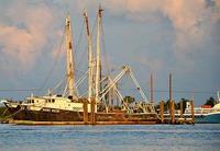
美國國家海洋和大氣管理局在2日宣布,受到鑽油平台油污污染的大片聯邦水域,已經禁止漁撈,受影響的主要地區從路易斯安那的密西西比河口到佛羅里達的彭薩科拉灣(Pensacola Bay),即刻生效。禁漁令將持續至少10天。
「NOAA(國家海洋暨大氣總署)的科學家們正在受到石油洩漏污染的地區採取水樣與海產樣本,以確保海鮮與漁業活動的安全,」NOAA署長盧布琴科(Jane Lubchenco)博士說,她已經在4月30日晚上與路易斯安那普拉克明(Plaquemines Parish)的100多位漁民見過面。
「我已經聽說普拉克明與其他地方漁民,以及州漁業局對禁漁令所可能造成潛在經濟影響的關切,」盧布琴科說。
「經濟與健康問題必須要取得平衡,禁漁區目前只有在受石油污染地區,在現在的海產市場上,不容許有任何的健康風險,」她說。
盧布琴科博士在上週六搭乘NOAA的飛機飛越油污區時,看到了鑽油平台所洩漏的程度,NOAA的科學技術協調員向路易斯安那州州長金達爾(Bobby Jindal)進行了簡報。
NOAA是美國商務部的一個機構。商務部長駱家輝(Gary Locke)說:「在這個極具挑戰性的時刻,我們的立場與美國漁民及其家屬,還有沿海經濟活動受到衝擊的社區一致。捕魚對我們的生活品質與經濟活動至關重要,我們會盡一切力量保護它。」
聯邦與州政府都由一套監控與測試海鮮安全的系統,禁止售油污染地區的產品與農漁作物進入市場,駱部長說。
NOAA漁業部正與美國食品暨藥物管制局(FDA)緊密合作,以確保水產品的安全,評估海鮮受到汙染的程度對人類健康的影響。
「在墨西哥灣油污污染區附近,有魚、螃蟹、牡蠣與蝦,」NOAA漁業部東南區主管克拉布特里(Roy Crabtree)說。「這個海灣是一個重要的生物與經濟區域,生產海鮮並有休閒漁業產業。」
根據NOAA最新一年的資料顯示,2008年間,墨西哥灣地區有320萬人從事休閒漁業,總共進行了2400萬次的航次。2008年海灣地區的漁民共捕獲超過10億磅的魚類與貝類。
NOAA與州長正在評估是否要申報重大漁業損失,以便聯邦政府在這區域對漁民提供補助。州長金達爾已經提報重大漁業災害損失。
「我要強調這一點『這事件不僅僅是對我們的海岸,而是與整個路易斯安那州人民根本的生活方式有關。我們的捕蝦業者、我們的漁民,路易斯安那的海岸是運動員的天堂』是這一切構成了本州以及我們的生活方式。我們必須做任何能夠保護我們的土地、經濟以及社區的事情,」州長說。
在聖坦曼尼教區,區長戴維斯(Kevin Davis)正與海岸防衛隊敲定一項計畫,以減輕漏油對龐恰特雷恩湖(Lake Pontchartrain)和教區的影響。該計畫包括發包一項在龐恰特雷恩湖,大約7000呎長的攔油索或是類似的工程。
NOAA該區漁業部代表將在本週內與漁民會談,以協助他們。密西西比以及路易斯安那都要求NOAA宣告聯邦漁業重大災難。
BP公司將招募漁民以協助他們在墨西哥灣清除油污並且部署攔油索。目前蚵農已經用他們裝牡蠣的麻袋交換橘色的攔油索,並且開始部署。
NOAA將依照油污污染變化的情況持續評估禁漁的需要,並且在適當的時即重新開放捕撈。NOAA也將以新的資訊重新評估禁漁區,可能會視情況調整禁漁區大小。
President Barack Obama is getting an up-close look at the massive Deepwater Horizon oil spill today. The President traveled by motorcade along the Mississippi River through marshy lowlands southeast of New Orleans toward Venice, Louisiana.
At the mouth of the Mississippi, Venice is community nearest to the scene of the explosion and fire aboard the oil rig Deepwater Horizon on April 20. The drilling rig burned for 36 hours before sinking in the Gulf of Mexico, leaving crude oil spewing from the broken wellhead on the seafloor and from two other breaks in the piping now strewn across the bottom of the ocean at the rate of at least 5,000 barrels a day.
Effective immediately, fishing is restricted in federal waters most affected by the Deepwater Horizon oil spill, largely between Louisiana state waters at the mouth of the Mississippi River to waters off Florida's Pensacola Bay, the National Oceanic and Atmospheric Administration announced today. The restrictions will last for at least the next 10 days.
"NOAA scientists are on the ground in the area of the oil spill taking water and seafood samples in an effort to ensure the safety of the seafood and fishing activities," said Dr. Jane Lubchenco, NOAA Administrator, who met with more than 100 fishermen in Louisiana's Plaquemines Parish on Friday night.
"I heard the concerns of the Plaquemines Parish fishermen as well other fishermen and state fishery managers about potential economic impacts of a closure," said Lubchenco.
"Balancing economic and health concerns, this order closes just those areas that are affected by oil. There should be no health risk in seafood currently in the marketplace," she said.
Dr. Lubchenco saw the extent of the Deepwater Horizon spill Saturday as she flew over the spill in a NOAA Twin Otter, while NOAA scientific support coordinators briefed Louisiana Governor Bobby Jindal.
NOAA is a bureau of the U.S. Department of Commerce. Secretary of Commerce Gary Locke said, "We stand with America's fisherman, their families and businesses in impacted coastal communities during this very challenging time. Fishing is vital to our economy and our quality of life and we will work tirelessly protect to it."
The federal and state governments have systems in place to test and monitor seafood safety and to prohibit harvesting from affected areas and keeping oiled products out of the marketplace, Locke said.
NOAA Fisheries is working closely with the U.S. Food and Drug Administration and the States to ensure seafood safety, by assessing whether seafood is tainted or contaminated to levels that pose a risk to human health.
"There are finfish, crabs, oysters and shrimp in the Gulf of Mexico near the area of the oil spill," said Roy Crabtree, NOAA Fisheries Southeast Regional administrator. "The gulf is such an important biologic and economic area in terms of seafood production and recreational fishing."
According to NOAA, there are 3.2 million recreational fishermen in the Gulf of Mexico region who took 24 million fishing trips in 2008, the latest year for which figures are available. Commercial fishermen in the gulf harvested more than one billion pounds of finfish and shellfish in 2008.
NOAA is working with the state governors to evaluate the need to declare a fisheries disaster in order to facilitate federal aid to fishermen in these areas. Governor Jindal has applied for a fisheries disaster declaration.
"I want to be very clear on this point 'this incident is not just about our coast. It is fundamentally about our way of life in Louisiana. Our shrimpers, our fishermen, the coasts that make Louisiana Sportsmen's Paradise' this all makes up Louisiana and this is our way of life. We have to do absolutely everything we can to protect our land, our businesses and our communities," the governor said.
In St. Tammany Parish, Parish President Kevin Davis is finalizing a plan with the Coast Guard to mitigate the impact of the spill on Lake Pontchartrain and the parish. The plan includes contracting a vendor to place around 7,000 feet of boom or a similar containment structure around Lake Pontchartrain.
NOAA fisheries representatives in the region will be meeting with fishermen this week to assist them. Mississippi as well as Louisiana has requested NOAA to declare a federal fisheries disaster.
BP will be hiring fishermen to help clean up from the spill and deploy boom in the Gulf of Mexico. Already, oyster harvesters are trading their burlap bags for orange oil booms and heading out to lay boom.
NOAA will continue to evaluate the need for fisheries closures based on the evolving nature of the spill and will re-open the fisheries as appropriate. NOAA will also re-evaluate the closure areas as new information that would change the dimension of these closed areas becomes available.


