颱風季登場 美氣象局:太平洋發生機率增7成 | 環境資訊中心
國際新聞

颱風季登場 美氣象局:太平洋發生機率增7成

2015年07月02日
摘譯自2015年6月1日ENS美國,馬里蘭州,大學公園市報導;周念學編譯;蔡麗伶審校

颱風季節正式在上個月登場,根據美國氣象預報資料,今年大西洋颱風侵襲機會可能低於往年,而太平洋地區則將高於往年。
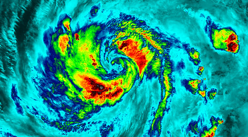
2015年形成於東北太平洋的颱風布蘭卡(Blanca)。圖片來源:NASA Goddard Photo and Video。(CC BY 2.0)

颱風機率較往年高 太平洋注意了!

美國國家海洋和大氣管理局(NOAA)依據今年聖嬰現象的發展狀況估計,東部和中部太平洋颱風侵襲機率將大於往年。

根據NOAA的估計,東太平洋颱風侵襲的地帶有百分之70的機率形成15至20個暴風,其中7至12個有發展成颱風的條件,再其中的5至8個會形成超級颱風;而太平洋中部颱風侵襲的地帶,將有百分之70的侵襲機率高於往年,可能會形成5至8個熱帶氣旋。

美國聯邦緊急事務管理署(FEMA)副行政主管Joseph Nimmich警告:「只要一個颱風或熱帶暴風所造成的土石流,就足以摧毀你的人生。每個人從現在就須為自己和家人作好準備防範暴風或颱風來襲。」

Nimmich建議:「完善家庭連絡機制、準備家庭緊急工具包、花些時間熟悉自家社區的逃生疏散路線。事先了解萬一災害發生在你身上時該如何因應確實能拯救自己,讓自己在災害發生時能快速因應。」

颱風機率較往年低 大西洋仍不可輕心

此外,NOAA預測大西洋地區會有百分之70的機率,產生6至11個風速每小時39英里甚至更快的暴風,而其中約有3到6個可能升級成颱風,風速每小時74英里以上。

這項預測發現,大西洋地區會形成兩個主要的颱風,歸類在風速等級3、4或5,每小時風速達111英里以上。

NOAA總結,大西洋地區受颱風肆虐的機率會有百分之70的機率低於往年,不過仍有百分之20的機率和往年相當,百分之10的機率則高於往年。NOAA轄下的國家颱風中心提醒:「但這不表示沿海地帶可以就此鬆懈。」

領導颱風季節預報員的NOAA氣候預測中心人員Gerry Bell博士表示:「今年主要就是聖嬰現象抑制了颱風侵襲程度,此氣候現象已影響風和氣壓結構,且預估會持續整個颱風季節。」

Bell說:「聖嬰現象會隨著季節時間往前而加強,預估在颱風季節的高峰期影響最大。我們也期望大西洋海平面溫度接近正常值,才能避免較溫暖的海水助於形成暴風。」

風觀測系統更新 圖像警示機制

因應今年的颱風季節,NOAA的國家颱風中心發展出新的風暴潮觀測和圖像警示機制。圖像清楚標示颱風季裡,美國大西洋和墨西哥灣沿海產生的風暴潮,所帶來危及人類生命的洪水氾濫區域。

分別發佈的這兩種危險警告中,內容應提供緊急逃生指揮人、媒體和社會大眾面對颱風來臨時更妥善的緊急災難因應策略。

颱風天氣研究和預測模型資料彙整系統,會更有效利用空中飛行器所蒐集的資料(Tail Doppler Radar data),而使預測颱風的準確度比去年高出百分之5。

2015 Atlantic Hurricane Risk Down, Pacific Risk Up
COLLEGE PARK, Maryland, June 1, 2015 (ENS)

The 2015 hurricane season officially opened on Monday as U.S. weather forecasters predicted a “below-normal” risk of hurricanes in the Atlantic and “above-normal” risk in the Pacific.

“But that’s no reason to believe coastal areas will have it easy,” said the National Oceanic and Atmospheric Administration’s National Hurricane Center in its annual prediction.

While NOAA forecasters are calling for a 70 percent likelihood of a below-normal season in the Atlantic, there is also a 20 percent chance of a near-normal season, and a 10 percent chance of an above-normal hurricane season.

NOAA is predicting a 70 percent likelihood of six to 11 named Atlantic storms with winds of 39 mph or higher, of which three to six could become hurricanes with winds of 74 mph or higher.

The prediction is for up to two major Atlantic hurricanes of Category 3, 4 or 5 strength with winds of 111 miles per hour or higher.

“A below-normal season doesn’t mean we’re off the hook. As we’ve seen before, below-normal seasons can still produce catastrophic impacts to communities,” said NOAA Administrator Dr. Kathryn Sullivan. She was referring to the 1992 season in which only seven named storms formed, yet the first was Andrew, a Category 5 major hurricane that devastated South Florida.

“The main factor expected to suppress the hurricane season this year is El Niño, which is already affecting wind and pressure patterns, and is forecast to last through the hurricane season,” said Gerry Bell, Ph.D., lead seasonal hurricane forecaster with NOAA’s Climate Prediction Center.

NOAA will issue an updated outlook for the Atlantic hurricane season in early August, just before the historical peak of the season.

“El Niño may also intensify as the season progresses, and is expected to have its greatest influence during the peak months of the season,” said Bell. “We also expect sea surface temperatures in the tropical Atlantic to be close to normal, whereas warmer waters would have supported storm development.”

The Eastern Pacific and Central Pacific will have above-normal risk of hurricanes, NOAA predicts, also based on  the presence of El Niño, a band of warm ocean water that develops off the Pacific coast of South America.

For the Eastern Pacific hurricane basin, NOAA’s 2015 outlook is for a 70 percent probability of 15 to 22 named storms, of which seven to 12 are expected to become hurricanes, including five to eight major hurricanes.

For the Central Pacific hurricane basin, NOAA’s outlook is for a 70 percent chance of an above-normal season with five to eight tropical cyclones likely.

“It only takes one hurricane or tropical storm making landfall in your community to significantly disrupt your life,” said FEMA Deputy Administrator Joseph Nimmich. “Everyone should take action now to prepare themselves and their families for hurricanes and powerful storms.”

“Develop a family communications plan, build an emergency supply kit for your home, and take time to learn evacuation routes for your area,” Nimmich advised. “Knowing what to do ahead of time can literally save your life and help you bounce back stronger and faster should disaster strike in your area.”

With the new hurricane season comes a new prototype storm surge watch and warning graphic from NOAA’s National Hurricane Center.

The graphic will highlight areas along the Gulf and Atlantic coasts of the United States at risk of life-threatening inundation by storm surge during a tropical cyclone.

Storm surge is often the greatest threat to life and property from a tropical cyclone, and it can occur at different times and at different locations from a storm’s hazardous winds. In addition, while most coastal residents can remain in their homes and be safe from a tropical cyclone’s winds, evacuations are often needed to keep people safe from storm surge.

Having separate warnings for these two hazards should provide emergency managers, the media, and the general public better guidance on the hazards they face when tropical cyclones threaten.

Also new this season is a higher resolution version (two kilometers near the storm area) of NOAA’s Hurricane Weather Research and Forecasting model, HWRF.

The  new HWRF data assimilation system will make better use of aircraft reconnaissance-based Tail Doppler Radar data for a five percent improvement in the intensity forecasts compared to last year.

※ 全文及圖片詳見:ENS

作者

周念學

親近大自然,精神上總是愉快的。

蔡麗伶(LiLing Barricman)

In my healing journey and learning to attain the breath awareness, I become aware of the reality that all the creatures of the world are breathing the same breath. Take action, here and now. From my physical being to the every corner of this out of balance's planet.